You can access our final report of this project a html version here, and a formal report version here, as well as the slides for the final presentation. :)
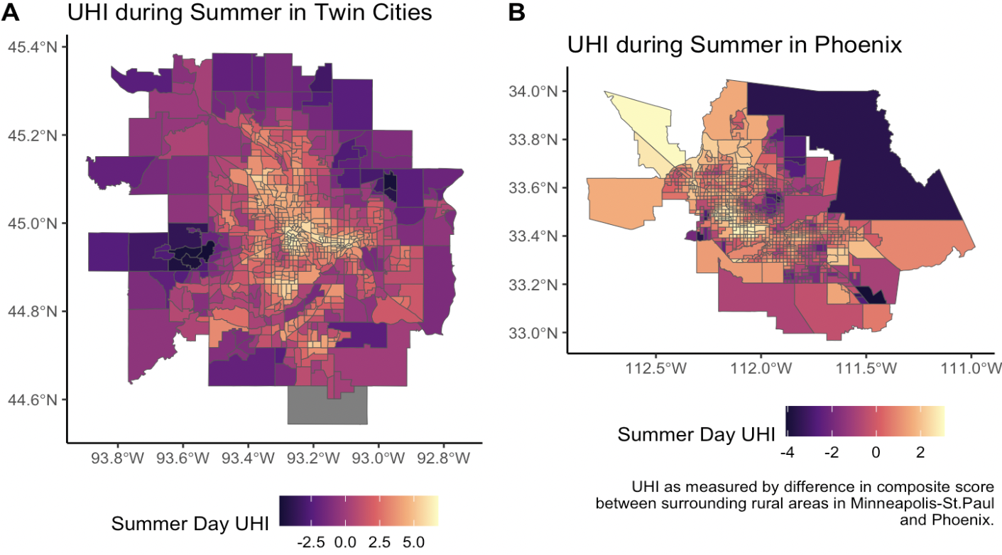
In collaboration with Marshall Roll, we conducted a comprehensive assessment to provide a rigorous spatial analysis of these trends in Minneapolis-St. Paul and Phoenix and to compare model similarity and performance between these two cities. Our analysis confirms that race, income, and house value are significantly connected to UHI distribution, but individual spatial models can help to pinpoint unique distribution patterns by city that can then be used to inform policy implementation.
